Description
Garmin Montana 700i in Kenya
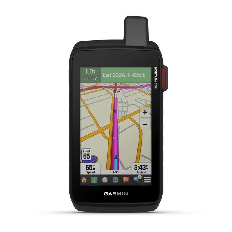
Garmin Montana 700i Price in Kenya starts at Ksh. 90,500. The Garmin Montana 700i is a robust handheld GPS device designed for outdoor enthusiasts who demand reliable navigation and global communication capabilities. Combining advanced mapping features with inReach® satellite technology, the Montana 700i ensures you stay connected and on course during your adventures.
Garmin Montana 700i Specifications
| Specification | Details |
|---|---|
| Display Size | 5.0″ diagonal |
| Display Resolution | 480 x 800 pixels |
| Display Type | Transflective, color TFT, touchscreen |
| Dimensions | 9.19 x 18.30 x 3.27 cm (3.62″ x 7.2″ x 1.29″) |
| Weight | 397 g (14 oz) with included lithium-ion battery |
| Battery Type | Rechargeable, internal lithium-ion battery |
| Battery Life | Up to 18 hours in GPS mode; up to 330 hours in expedition mode |
| Water Rating | IPX7 |
| Memory | 16 GB internal |
| Expandable Storage | microSD™ card slot |
| Waypoints/Favorites/Locations | 10,000 |
| Routes | 250 |
| Track Log | 20,000 points; 250 saved tracks |
| Sensors | Altimeter, barometer, 3-axis compass |
| Wireless Connectivity | Bluetooth®, ANT+® |
| Interface | USB-C |
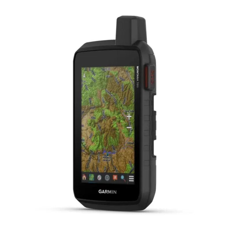
| Preloaded Maps | TopoActive maps |
| Multi-GNSS Support | GPS, GLONASS, Galileo |
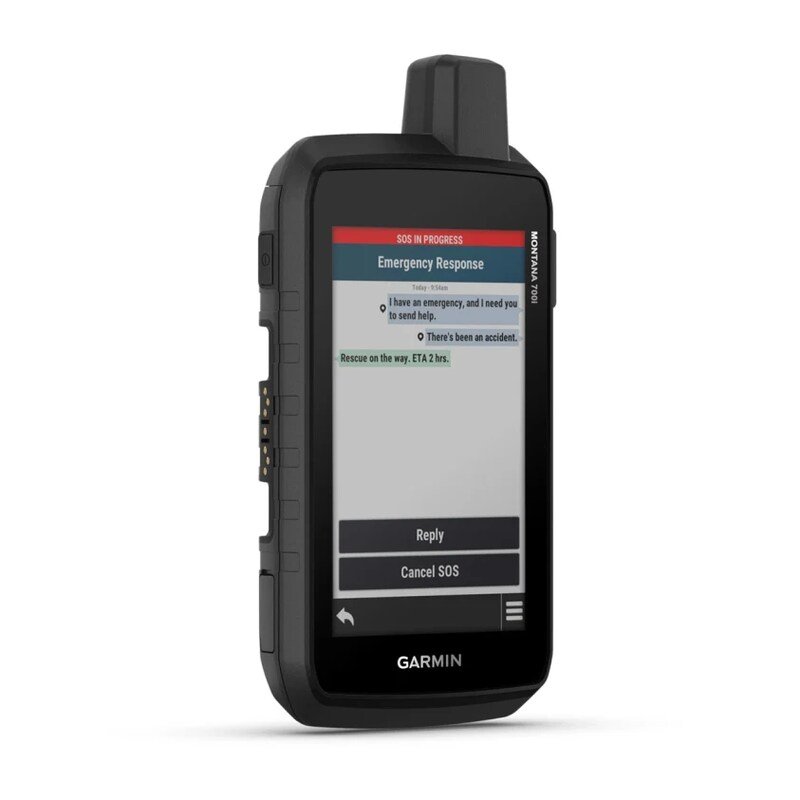
| inReach® Technology | Yes, for satellite communication |
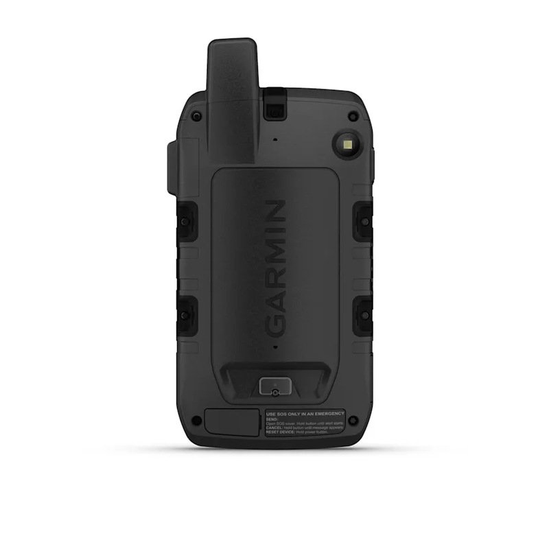
| Camera | No |
Key Features
- inReach® Satellite Communication: Utilizes the Iridium® satellite network for two-way messaging, interactive SOS alerts, and location sharing, providing peace of mind in remote areas.
- Large Touchscreen Display: Features a 5-inch, glove-friendly, color touchscreen display that offers crisp and clear visuals in various lighting conditions.
- Multi-GNSS Support: Accesses multiple satellite systems (GPS, GLONASS, and Galileo) for accurate positioning, even in challenging environments.
- ABC Sensors: Equipped with an altimeter for elevation data, a barometer to monitor weather, and a 3-axis electronic compass for precise navigation.
- Preloaded TopoActive Maps: The Garmin Montana 700i handheld GPS comes with detailed TopoActive maps, providing comprehensive views of routable roads and trails, ideal for hiking, cycling, and off-road adventures.
- Wireless Connectivity: Pairs with compatible smartphones via Bluetooth® and ANT+® technologies, allowing access to smart notifications and additional mapping resources.
- Rugged Design: Built to withstand harsh conditions with an IPX7 water rating, ensuring durability during outdoor excursions.
The Garmin Montana 700i handheld hiking GPS navigator is an essential tool for explorers seeking reliable navigation and communication features, ensuring safety and connectivity during their outdoor pursuits.
Shop for more Handheld GPS in Kenya.


Reviews
There are no reviews yet.